Cusco can be a bit chaotic and is far from a walker’s paradise, so we we always looking for reasons to get out! And what better place than some peaceful ruins? The Saqsaywaman Ruins, just 2 km north of the main square in Cusco, is the most important military fort of the Incan empire, often compared with its grandness to the Roman Colosseum. However, nearly every English speaker will inevitably have a moment of pause, when they realize how Saqsaywaman is pronounced…something quite similar to “Sexy Woman.” We made a day of visiting Saqsaywaman (see you’re already pronouncing correctly, right?) alongside three other ruins because all were included on the “circuit one” tourist ticket (a hefty 70 sols or $18/each) and the sneaky tourism board has made it so you can’t visit just one.

You can take a tour to get to all four sites if you want to drop some bucks, or you can make up your own way, like us. However, if you’re going to do this circuit on foot (and a little bus) as we did, be prepared to get in around 25,000 steps and get lots of bun action. Also, make sure you’re acclimatized first because you gain several hundred feet. We used the Mapy.cz app the whole day to get us from ruin to ruin, ending with a beautiful walk through an ancient Inca Trail.

Leaving the city behind it gets very beautiful, very quickly.
Saqsaywaman Ruins

Mandy wasted no time and scrambled to the top of the massive stones laid in the 14th & 15th Centuries.


While she was doing this, Greg preferred to admire the construction and magnificence down below. Some of these blocks weigh as much as 300 tons and are the size of a house. Most of the stone was quarried about 2-20 miles away. It is not known how such massive stones were moved. There was no animal labor and unlike the Mayans, they did not use large logs to roll stones or even use the wheel. Also, keep in mind that the Incans mostly used other stones, bronze or copper tools to build, usually splitting the stones along the natural fracture lines.

One of the doorways leading into the fort.

In 1536, this fort was the site of one of the most bitter battles in the Spanish conquest. The zigzag outline of the wall along the sloping mountaintop was a unique defensive design that allowed defenders within the fortress access points that would intrude into attacker’s lines (Smithsonian Journeys Cultural Peru). Not sure how effective this was…obviously.

Shortly after the conquest and massacre of all the natives, the Spaniards lovingly tore down many walls and used the blocks to build their own houses in Cuzco. Fortunately, they left the largest and most impressive rocks, (probably because they were also the heaviest.)


It is absolutely remarkable how the Incans were able to move and chisel all these tremendous stones into place.

Unfortunately we couldn’t access the other side of the ruins, which to us looked the most inviting.

A solitary llama stands in the field of Saqsaywaman. By the way, the name actually means, “The place where the hawk is satiated” not woman-who-looks-fine.

They are just so adorable.
When the llamas show the canine who is boss!

Being careful to avoid their poo (not as adorable), Mandy embraces her inner child and practices her handstand.


From Saqsaywaman, we headed up the hill toward the 26 foot Cristo Blanco statue. Which, like most open-armed Christ statues…

….has an unbelievable view of the city. You can see Plaza de Armas in the foreground. Interesting tidbit: The name Plaza de Armas, which literally means “Weapons Square,”derives from the fact that this would have been a refuge in case of an attack upon the city, from which arms would be supplied to the defenders. Almost all main squares in Peru were named this.
Q’enqo Ruins


We walked to the second site of Q’enqo from Saqsaywaman via Cristo Blanco which took about 50 minutes. The name of this small ruin means “zigzag” probably because it’s laced with niches, steps and extraordinary carvings. It has a subterranean cave and kind looks like something aliens created when you approach it from the street.

And a great thing about traveling in the spring? All the sites are loaded with wildflowers including these wild orchids.
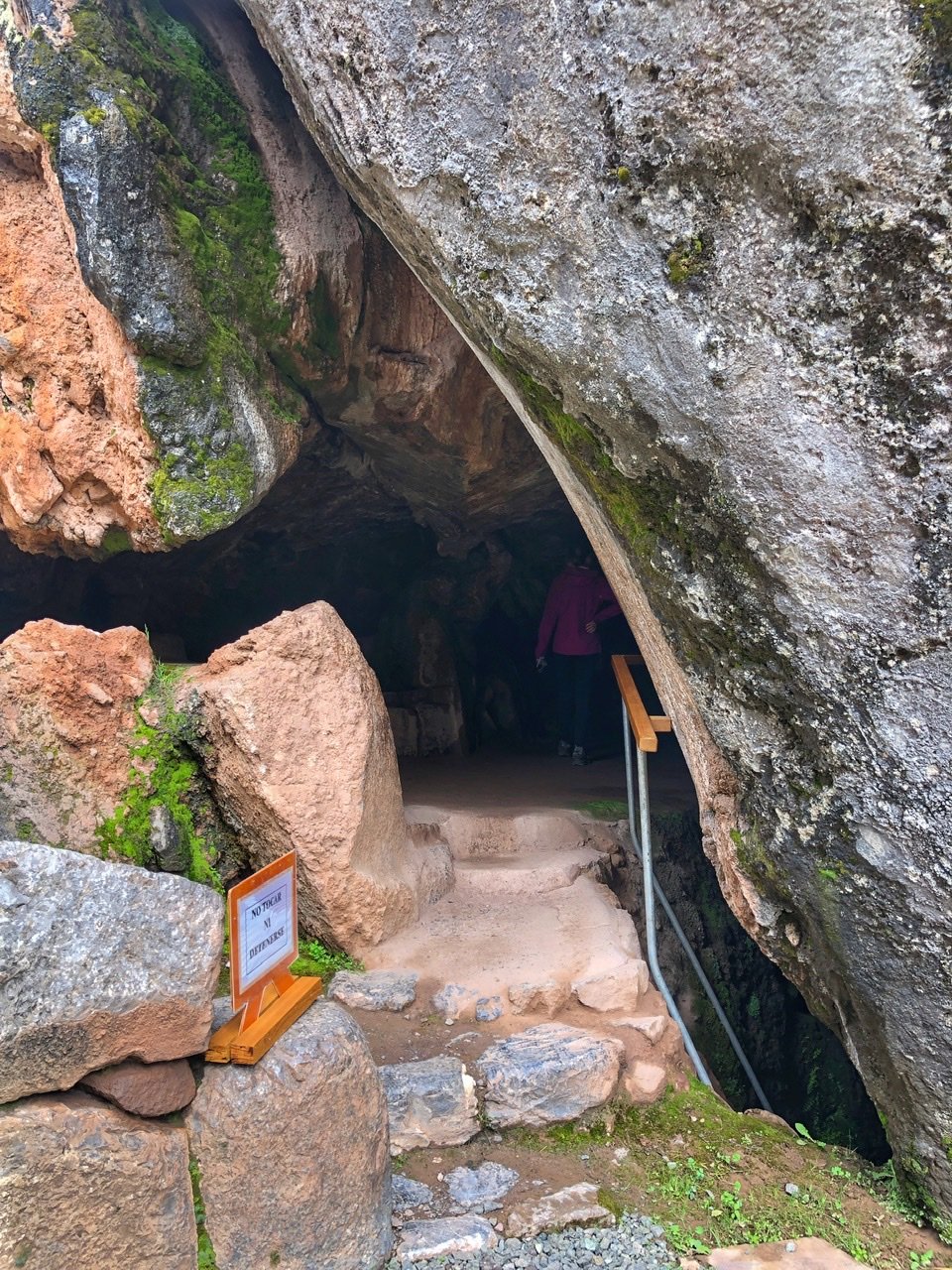
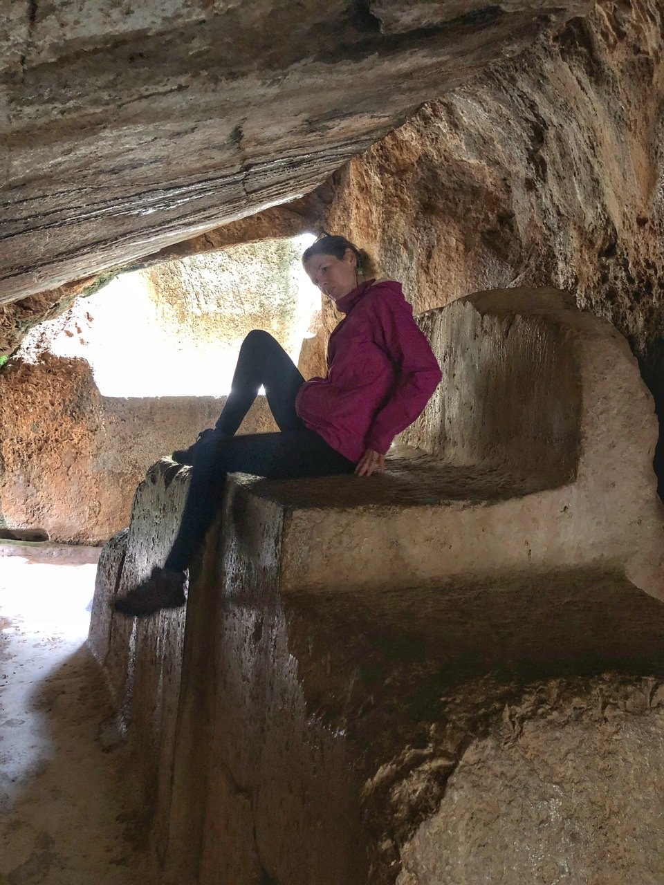
Entering the subterranean cave, but do NOT touch anything!! Mandy got yelled at for trying to sit on the throne, which is why this picture looks like this ?
Tambochay Ruins

From Q’enq’o, we walked up to the main road and jumped on a local bus (2 sols or $.50) going to Tambochay, the furthest, most well preserved and most striking of the ruins, which saved us another 4.2 km of walking. This one is known as El Baño del Inca, which is where the Incans worshiped water as well as bathed.

The water features were everywhere at Tambochay.

And sitting on the path on the way to Tambochay, we absolutely fell for this sweet lady and her little friends on a walk in the ruins today. Peruvian women’s traditional clothes typically include brightly colored dresses, blankets, tunics, skirts and of course…hats. In fact, you can tell what town she is from just by looking at her hat.
Pukapukara Ruins

The last ruin is across the street from Tambochay and is called Pukapukara. In some lights, evidently the stone looks a red color and the name literally means “Red Fort.” However, archeologists believe it’s more likely to have been a hunting lodge, and a stopping point for travelers. So basically, the Red Inn. This site was way more interesting from a distance than inside it.

The views from Pukapukara are commanding of the Cusco Valley.
Hiking in the Cusco Valley
After Pukapukara, it was time for lunch so we walked south back on the road to the village of Huayllarcocha, where a collection of local restaurants gathered, careful to avoid any with open air tour buses. Mandy grabbed a standard Trucha Frita and Greg, pollo a la plancha. We both avoided the cuy (Guinea pig,) although our walking tour guide did point out that they’re incredibly environmentally sustainable. This is true when compared with cows, pigs or llamas of course so if you’ve gotta eat red meat, go for the rodent!! The meals were 25 sols or $6.25. Prices are definitely more in Cusco.


The small neighborhood where we had lunch.

From there, we used Mapy to guide us off the road into a lush, green gulley, which ended up being our favorite part of the day.

It led us by more (free!!) off the beaten ruins rarely visited by tourists, including this small ceremonial site, called Chuspiyoq. There are two paths that take you by it. We had to choose the north one because the other was soaking wet from the creek.

Continuing down a beautiful path, we found our way to Templo de La Luna, or Temple of the Moon. Andean cosmology is characterized by a deep respect for many energy entities such as the Moon or Mother Earth (Pachamama in Quechua language) because they are closely connected with Agriculture, the main economic source in the Inca period. Make sure to leave a blessing to the moon while here, or in Mandy’s case, grab a quick snooze to appreciate the nocturnal qualities this place holds.

The inviting view gazing down from Temple of the Moon. We loved this temples. It was were empty, spiritual and completely serene.

You can even walk underneath the temple. We only got a little peek because it was cordoned off.

Temple of the Moon from down below.

The entire valley is strewn with ancient Incan trails. The main purpose for the roads was for communication, moving army troops, and to transport goods. Commoners were not allowed to travel on the roads.


A map of some of the Incan trails throughout the empire.

The rest of our (rain-free!!) hike was a long, walk down the old Camino del Inca al Antisuyo road into Cusco. The contrast between where we were in the foothills and the massive half a million city below was imposing.

Where the trail begins dropping into the city.


And amazingly, it drops directly into the most charming neighborhood of them all…back in San Blas. We couldn’t help but weave through the maze of cobbled streets some more…

And grab a banana juice to reward ourselves for the day’s adventure.
Rainbow Mountain (Vinicunca)

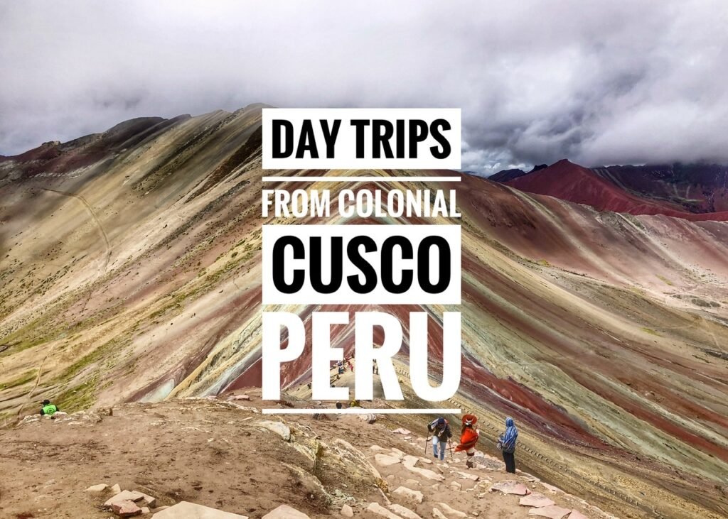
Rainbow Mountain, or Vinicunca, launched us to the highest point we’ve ever been at 5036 meters (16,522 feet or more than half of Mount Everest.) This is a site which has blown up in popularity over the last few years thanks to it being plastered all over Instagram and in travel magazines. Also, in reality, Rainbow Mountain didn’t really exist until 2015. Or rather, the mountain had always been around, but its most sought after feature was concealed for centuries under massive layers of snow and ice. And then, most likely due to climate change, it progressively melted away. So that’s the unfortunate truth. ?
We actually debated if we should even do it because it’s so touristy. But, in truth, we’re really glad we did because we lucked out with decent weather, found a small tour group to go with, and got there before the “crowds” arrived. Being during a pandemic and low season helped significantly with this however. Before COVID, there were about 10-15,000 people visiting per day and now it’s around 500. In short, if you’re not traveling now, get a move on because you’re missing out!

It’s not Rainbow Mountain without posing with new cool friends. It’s very nice to snuggle up with a llama, but we couldn’t help but wonder…are the sunglasses really necessary?


The mountain’s Skittle-like appearance is created by the sediment of minerals throughout the area giving the mountain the turquoise, lavendar, gold and other colors. Obviously we were there on a cloudy day so you don’t get the full effect. (Note: our photos are edited slightly, not obscenely like many photos out there…the photo on the left is edited, and the right one is not.)

We made it!! It was a long slog in. Not so easy to walk at this altitude, but we did fine.

Looking down the valley.

Our group of 9 (3 Germans, 2 Colombians, & 3 Americans.) There were actually ten but one poor lady had so much trouble with the altitude, she had to turn around. Our guide brought a tool to detect oxygen levels and oxygen for emergencies, but she was in tough shape before we even got started. Apparently you can tell just by looking at the color and texture of your fingers. You definitely can’t mess around with it!

More sunglassed llamas staying warm as the epic Mount Ausangate looms in the background (6384 meters or 20,944 feet).


Mandy making it to the very top, where it was very cold! She forgot to remove her mask before the hike, so enjoy the chin strap!!

We’ve never seen a natural wonder more radiant! It’s also insane how rapidly the weather changed up there. We experienced sun, clouds and a complete white out of the mountain in our 30 minutes on top.


Now listed as one of the “Top 100 things to see before you die” according to National Geographic.

A view of the gorgeous Andes at eye level.

Vinicunca, a word originating from Peru’s native tongue Quechua, translates to “colored mountain.”
Our guide took this fun video of all of us at the top! Did we mention it was SOOOOO cold!

The crowds were beginning to congeal as we came down from the mountain. We’re so happy we chose a tour group through Airbnb Experiences that chose a 4 am departure from Cusco for this very reason. And it was also a terrific value. Cost was $61.40 for both of us which included transportation, walking poles, guide, and a buffet breakfast and lunch.

The walk to get to and from Rainbow Mountain was also breathtaking and took about 45 minutes. Ausangate looms in the background.
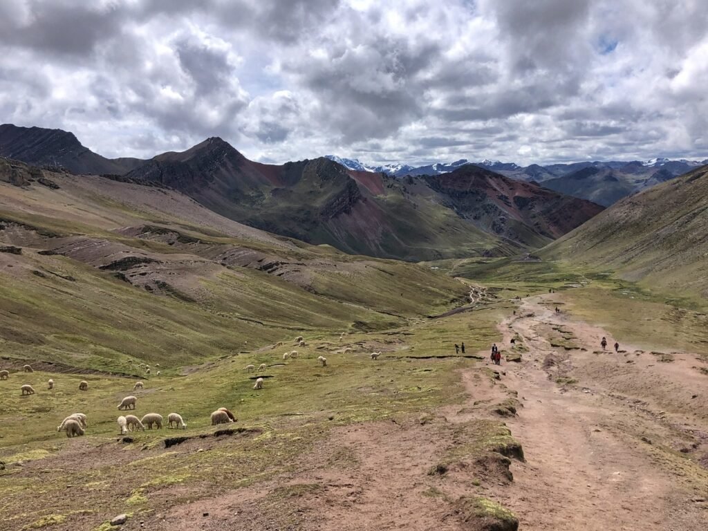
The valley was dotted with only a few people on the walk up…

And lots and lots of frolicking alpaca and llamas.


Greg stops to admire Ausangate.

Wow!! Also, we really lucked out with the weather. The advantage of sitting in Cusco for two weeks awaiting the best day possible!

Arriving back at the parking lot where the horses congregate. If you’re not able to do the walk, you can always hop on a horse at anytime, which costs 80 sols or ~$20.

The spectacular view from the parking lot.

Not only was the hike itself incredible, we had no idea we’d be getting such a breath-taking, and a bit nauseating experience on the ride itself.


We drove over many high passes and encountered lots of obstacles along the way, including multiple places where the road was one way. With no guard rail…on a cliff plummeting into a valley. This made passing the few cars we did very tricky. Not for the faint of heart!! ? We saw our driver touch his crucifix hanging on his rearview mirror multiple times. Ummm….

Villages in the middle of nowhere.

And some very hairy twists and turns!!


Unbelievable view on this simply gorge-ous drive. So glad we did it.
The Town of Pisac

It’s hard not to gravitate toward the positive energy and happy hippie vibes as you arrive to the Andean Shangri-La town of Pisac. This colonial village is by far the most charming place we’ve been in Peru and is a must-see on any visit to Cusco. The entire town caters to spiritual seekers and offers everything from clean eating options, yoga retreats and hallucinogenic Ayahuasca adventures. Not surprisingly the town hosts quite a few expats gringos who have settled here permanently. It also offers a lot for the regular non-New Age tourist activities like ruins and a fantastic artisan market with some of the nicest handmade items we had seen.
Note: To get to Pisac, we took a colectivo from Cusco on Puputi Street. Cost was 5 sols ($1.25) each direction and the ride took about one hour. It’s a smoothly paved road with stunning views of the Andes but very winding.
Above is the entrance to the artisan market. Mandy started swooning over the impressive handmade table runners (right) as soon as she walked in. Being that we don’t have a house, or a table, however, it didn’t make a lot of sense. We considered it for a gift also until they told us the price was a whopping 500 sols, or $135(!) Even with skillful bargaining, we knew we’d have to pass. But wow. Truly beautiful. They probably took months to make.

Pausing for a trout ceviche lunch at La Paila overlooking the up-ended square. The plaza, unfortunately was a bit of a construction disaster. However, as soon as we plopped down to eat all the workers disappeared for their own lunches leaving us in blissful silence to soak in the Andes before us.

There are so many adorable places to eat in Pisac. The choice is a difficult one!

The best thing about Pisac, for us, was the fact that the entire village was pedestrian only. In many ways, it took us right back to many cozy villages in Colombia.

Despite the construction, it was incredibly beguiling.

And completely ringed by lush green peaks.

Heading up to the artisan market. Apparently, a local told us, the dummy is hanging on the pole as a remnant from Carnivals. In Pisac, there is a tradition of making replicas of local well known men (compadre) and women (comadre). They are voted on with a 1st, 2nd and 3rd place winner.

Friendly faces inviting us in.


So many things we would buy if we could!

And it didn’t rain on us once! Pisa is truly a shopper’s paradise.

Are we in Spain?!

Just some of the exploratory goodies being advertised. We could spend a lot more time in this town. In fact, we regret spending so long in Cusco and wish we’d parked in Pisac for a bit.

Another street scene. It was around here where we met Sanan, an American who runs a very admirable non-profit which provides service projects that benefit the entire community in culture, education, health and opportunities. Find at more at www.amistadsagrada.com. He’d been living in Pisac for 12 years and at one point also lived in Oregon.

Just had to point out the futuristic little tuk tuk tanks from Cusco. Fully enclosed to keep the cold out. In all our travels, we’ve never seen anything quite like it!
Ollantaytambo

We actually did Ollantaytambo as the last leg of our trip from Machu Picchu, but it’s also possible to do as a two-hour colectivo trip, or tour, from Cusco. This pueblo in the Sacred Valley is known for being the start of the Inca Trail, as well as the Ollantaytambo ruins, a massive Inca fortress with large stone terraces built directly on a hillside and easily viewable from the town. The town itself is the best surviving example of Incan city planning available and has narrow cobblestone streets that have been inhabited continuously since the 13th Century.


We stayed here for a night, and quickly discovered that after the masses pass through every morning en route to Machu Picchu, Ollantaytambo is a tranquil and wonderful place to be. In fact, we realized we’d much rather hang out there than in Aguas Calientes.


Its streets are narrow, winding and a perfect labyrinth of exploration activity. And we loved seeing the direct contrast between the “modern” town of Ollaytaytambo and the ruins directly behind it.


And had no shortage of cute doors and windows.
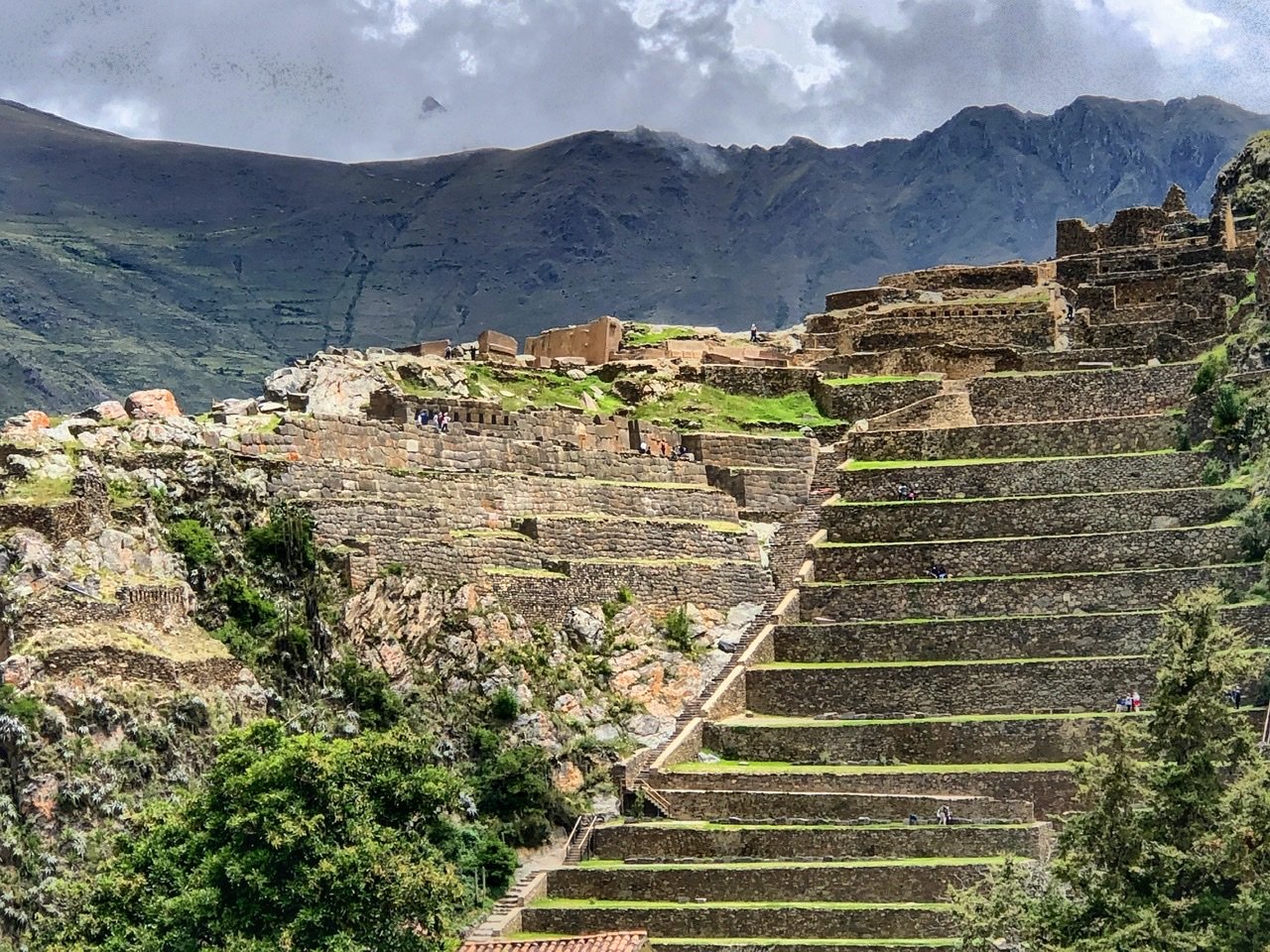

The massive precipitous ruins of Ollaytaytambo tower above the town and provide an unbelievable backdrop. It marks one of the few places where the Spanish conquistadors lost a major battle to the rebellious Manco Inca, who was the founder of the independent Neo-Inca State in Vilcabamba.
According to Lonely Planet Peru, “Manco Inca had retreated to this fortress after the defeat at Saqsaywaman. In 1536, conquistador Hernando Pizarro led a force of 70 men to Ollaytantambo to try and and capture Manco Inca, but were showered with arrows, spear and boulders from high above the steep terracing. In a brilliant move, Manco Inca flooded the plain below the fortress through previously prepared channels. With the Spaniard’s horses bogged down in the water, Pizarro ordered a hasty retreat, chased down by thousands of Manco Inca’s victorious soldiers.”

